Blue Ridge Parkway & Skyline Drive
Rockfish Gap, where Interstate 64 crosses over Afton Mountain 20 miles west of Charlottesville, is the northern end of the Blue Ridge Parkway (Milepost 0) and the southern end of the Skyline Drive (Milepost 105). Both roads follow the eastern ridgeline of the Blue Ridge Mountains and the Appalachian Trail. The Blue Ridge Parkway extends for 469 miles south to the Great Smoky Mountains National Park; Skyline Drive, which is part of the Shenandoah National Park, extends 105 miles north to Front Royal, Virginia.
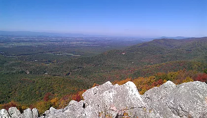
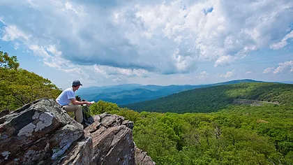
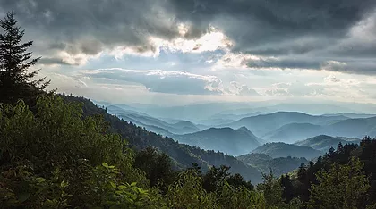
These roads, parks, and national forests are, without question, among the most scenic natural treasures of the eastern US. They offer magnificent cycling opportunities as well. Take either US 250 or I-64 to the top of the mountain, park in one of several available spots, and you’re ready to go.
Visitors to the area should particularly consider a ride on the Blue Ridge. There is plenty of exceptional riding in the Charlottesville region, but this experience is simply unique.
Things To Know
The respective ends of the Parkway and Skyline Drive are only a few hundred yards apart, so it’s easy to combine sections of both.
If you don’t already have a National Park pass, you will have to pay an entrance fee to get into Shenandoah National Park. If you are in a group, most park passes are valid for up to 4 bicyclists. The Blue Ridge Parkway has no entrance fee.
These roads are obviously quite hilly, typically in the range of 90-100 feet of climbing per mile. However, they are not particularly steep; grades rarely exceed 8-9%.
Temperatures tend to be around 4-5 degrees cooler on the mountains. These roads are generally not used by cyclists in the colder months of winter.
Stores
Within Shenandoah National Park, there are Waysides operated by the Park Service with restaurants and stores at Loft Mountain (Mile 79.5), Big Meadows (Mile 51.2), Skyland (Mile 42.5), and Elkwallow (Mile 24.1). Date and hours of operation vary seasonally, so check online before you ride.
There are no gas stations or stores (other than a hot dog stand) at the top of Afton Mountain. There is a motel, but it is not recommended. Food and lodging are available in Waynesboro several miles down the mountain.
There are no stores along the Parkway itself, at least in the first 45 miles, with the exception of a very small store at the Humpback Rocks Visitor Center at Mile 5.8.
There is a small store at Mile 16 on Love Road (Route 814) less than half a mile off the Parkway at the Royal Oaks Cabins.
There is a store at Montebello 2.5 miles down the eastern side of mountain on Crabtree Falls Highway (Route 56). The climb back up is steep. Route 56 crosses the Parkway at Mile 27.
There is a store at Vesuvius 4.5 miles down the western side of the mountain on the Tye River Turnpike (Route 56). The climb back up is long and steep. Route 56 crosses the Parkway at Mile 27.
Crossover Roads On Skyline Drive
The only paved road that crosses Skyline Drive in the Charlottesville region is US 33 at Mile 65 (40 miles north of Rockfish Gap). Both the east and west climbs up US 33 to the entrance of Skyline Drive are steep and winding, so use caution.
There are a few gravel roads that climb up the boundary of the National Park. They often have a connecting trail or fire road to Skyline Drive, but bicycles are not allowed on these trails and you have to walk.
Crossover Roads On The Blue Ridge Parkway
Mile 0 (aka Afton Mountain): Both US 250 and Interstate 64 cross the mountain at Rockfish Gap (Mile 0). Bicycling is allowed on US 250; traffic can be moderately heavy but the road is 2 lanes going up from east or west and cycling is reasonably safe (the road is mostly a single lane going down).
Mile 13.5 (aka Reeds Gap): Beech Grove Road (Route 664) drops down to Beech Grove on the east side of the Parkway. Reeds Gap Road (Route 664) drops down to Sherando on the west side.
Mile 16.1 (aka Love Gap): Campbell Mountain Road (Route 814) is a gravel road that drops down to the Tye River valley (Crabtree Falls Road) on the south/east side of the Parkway. Love Road (Route 814) drops down to the Sherando valley on the north/west side.
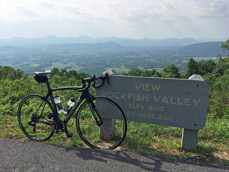
Mile 27 (aka Crabtree Falls or Vesuvius): Crabtree Falls Highway (Route 56) drops down on the east side of the Parkway past Montebello and Tyro in the Tye River Valley. Tye River Turnpike (Route 56) drops down on the west side to Vesuvius in the Shenandoah Valley. Yes, that’s correct: the Tye River is on the east side, but the Tye River Turnpike is on the west side.
Mile 45.6: US 60 crosses the Parkway.